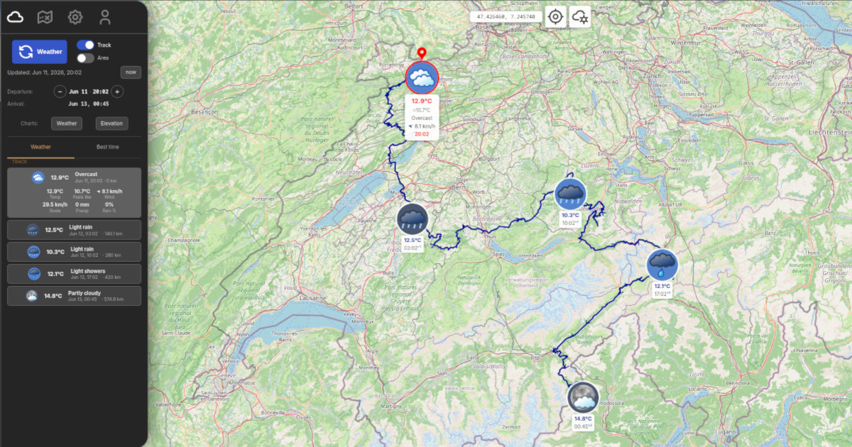
Load your GPX track or paste a Google Maps directions link, set when you leave and how fast you travel. WeatherGPX shows the forecast at every point along the route, timed to the exact hour you'll be there.
Three steps from route to forecast
Upload a GPX file or paste a Google Maps URL. WeatherGPX reads your track and calculates distances between points.
Tell WeatherGPX when you leave and your realistic average speed. It estimates your arrival time at each point along the route.
Temperature, wind, precipitation, at every point along the route, at the exact hour you'll be there. Up to 16 days ahead.
Wherever a route meets weather
Rain at the pass? Know what awaits at every ridge, timed to the exact hour you'll be there.
Read more →Summit weather at your exact arrival time. Mountain forecasts change fast , see what's at the top when you get there.
Read more →Headwind or tailwind, rain on the descent , know before you roll out. Every kilometer, every hour.
Read more →Planning a long drive? Paste your Google Maps route and see the weather at every stop, timed to your arrival.
Read more →Built for people who actually go out there
Tap the wand button on the map to open Quick Start. Load a GPX or Google Maps route and get a full weather forecast in one guided flow , no configuration, no learning curve.
Not a generic area forecast. The weather at that col, at the hour you'll actually cross it. Knowing it rains at 14h when you'll be at the top changes everything.
Powered by Open-Meteo, which aggregates forecasts from national meteorological services worldwide. Any route, any country, any terrain.
Not sure when to leave? WeatherGPX automatically calculates the 5 best departure slots for your route over the coming days.
Enable Area mode to get the current forecast for any spot on the map, just pan and tap. No track needed.
No account, no credit card , open it and get your first weather forecast in under a minute.
Why is there a paid plan? Weather forecasts and cloud storage have real costs. Subscribing covers them , and directly supports the development of WeatherGPX, which is built and maintained by one person.
WeatherGPX was built by an independent hiker and biker who ran into the same problem too many times: standing in the middle of nowhere, unsure whether to push on or turn back, with no real sense of what the weather was doing further along the route. The classic forecast, a city, a single point, a vague icon, just doesn't cut it when you're off-road and the next pass is two hours away.
WeatherGPX is free to use. Your tracks, weather data and map tiles are stored on your device, even without a connection you can access what you loaded before heading out. With a subscription, everything syncs to the cloud across all your devices.
Free, no account needed, works anywhere in the world.